Geology Pits
McLaren Vale is one of the most geologically diverse wine regions in the world. More than 40 unique geological units are present, ranging in age from less than 10,000 years to over 650 million years.
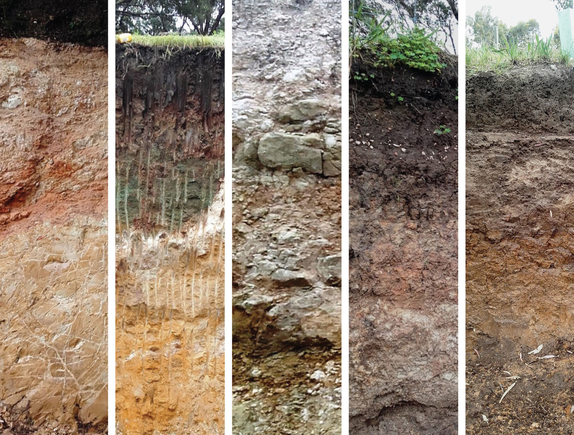
McLaren Vale Geology Pits
Geology pits have been excavated throughout our region to showcase this unique geology, and to further highlight the relationship between geology and our region’s fine wine.
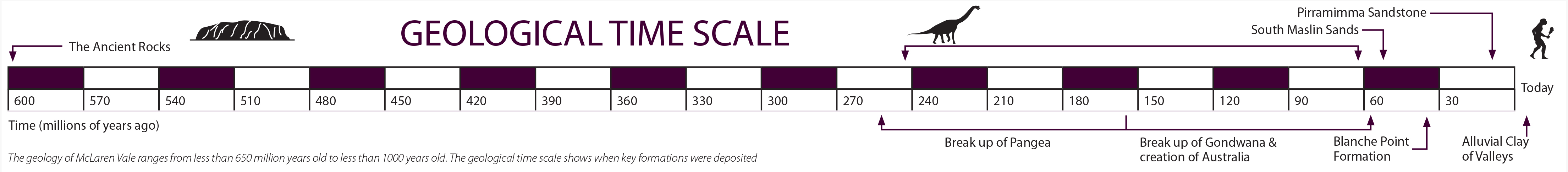
The Ancient Rocks is a term used to describe geological units in the region of age greater than 480 million years. These units occur beneath the Willunga Embayment (Willunga Basin) and also to its north, east and south.
The South Maslin Sands consists of sands, silts, clays and gravels deposited as the sea advanced over the land about 50 million years ago. It occurs extensively throughout the Willunga Embayment, from north of Kangarilla to Sellicks Beach.
The Blanche Point Formation consists of sand, silt, clay and limestone. These sediments were deposited in old river channels, lagoons and in shallow marine environments as Australia separated from Antarctica about 35 million years ago.
The Pirramimma Sandstone consists of grey, white and yellow sandstone, siltstone and clays. It is of Pleistocene age (about 2 million years old) and was deposited in an old river channel that extends from Blewitt Springs to the coastline at Aldinga Beach.
The Alluvial Clay of Valleys is a succession of modern age (Holocene) sediments occurring along and adjacent to watercourses in the McLaren Vale region, including Pedler Creek, Malpas Creek and Port Willunga Creek. These sediments generally consist of clay, silt and some minor sand and gravel deposits produced by erosion and surface runoff (stream flows) from the Sellick Hill Range.
GEOLOGICAL UNITS
This map divides the geological units in the McLaren Vale wine region into the following groups:
- The Ancient Rocks
- Tertiary Age units
- Quaternary Age units (Pleistocene)
- Quaternary Age units (Holocene)
Brief descriptions of geological units followed by a summary of how geology influences viticulture in McLaren Vale are illustrated using the symbols below.
| Geology | |
| Viticulture |
The Ancient Rocks
The Ancient Rocks were deposited between 800 and 500 million years ago and form part of the Adelaide Geosyncline (Adelaide Rift Complex). This was a large trough that developed in the ancient Australian landmass that became filled with a range of sediments including sands, silt, gravel, clay and limestone. The Adelaide Rift Complex was deeply buried and eventually uplifted to form the Mt Lofty and Flinders Ranges.
The Ancient Rocks are visible in elevated positions throughout the region, including the Sellicks Hill Range from Sellicks Hill to Clarendon and Mount Bold, at Onkaparinga Hills and Aberfoyle Park, and at Old Noarlunga. They also occur beneath younger sediments in the Willunga and Noarlunga Embayments.
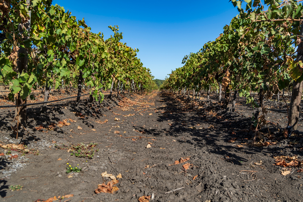
Few vineyards were planted on Ancient Rocks prior to the establishment of irrigation in the 1960s. Soils developed on the Ancient Rocks are often very thin, leading to the vine roots penetrating cracks and joints in the underlying weathered rock. Plantings on the Ancient Rocks occur near Clarendon and between Coriole Wines and Chapel Hill Wines, near Oliver’s Taranga and at Mollydooker on Seaview Road. At Chapel Hill, clayey soils contain fragments of shale and quartz gravel which enhance drainage and facilitate deeper penetration of vine roots into fractured rocks below.
Other notable vineyards on the Ancient Rocks include the Hillside Shiraz Vineyard at Kay Brothers Amery Winery and plantings at the gateway vineyard at Paxton Wines.
Tertiary Age Units
Tertiary Age units consist of sedimentary formations deposited in the Noarlunga and Willunga Embayments of the St Vincent Basin between 45 million and 2.6 million years ago.
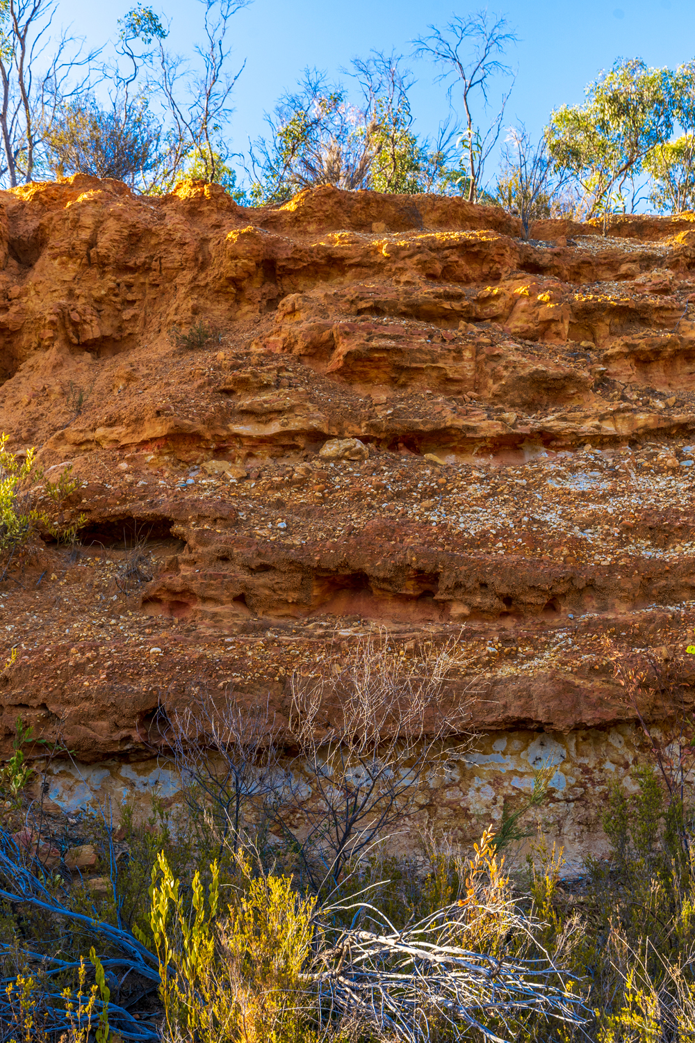
The North Maslin Sand occurs throughout the Willunga and Noarlunga Embayments and consists of red, orange and brown sand, silt, clay and gravel deposited by ancient rivers. During the Eocene Epoch, a marine transgression occurred and the sea advanced over the land, with wave action winnowing out the finer materials and introducing a marine component, the mineral glauconite. This marine influenced succession is called the South Maslin Sand.
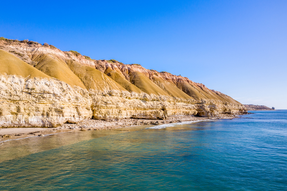
The North Maslin Sand is exposed in cliffs along the coast, in sand quarries at Maslin Beach and McLaren Vale and in numerous road cuttings near Seaview Road. South Maslin Sand is also exposed in coastal cliffs and in pit excavations at Kay Brothers Amery Winery.
The Maslin Sand units are important aquifers for water supply in the Blewitt Springs and Kangarilla areas.
Many of the oldest vineyards were planted on the Maslin Sand. As a result of geological variation in this unit, soils vary considerably from sandy loams to ironstone pebble and clayey horizons.
Some of these vineyards do not require irrigation, especially where deep soils occur. These soils can have a high water holding capacity providing vines access to moisture during summer.
The Blanche Point Formation was also deposited in the Eocene Epoch as the sea advanced easterly into the Willunga and Noarlunga Embayments. It consists of a succession of siliceous, calcareous and glauconitic clays and mudstones, often referred to as ‘marls’. It is exposed in cliffs along the coast, where the Tortachilla Limestone and Chinaman Gully Formation are also present, in the Willunga Embayment in road cuttings along Olivers Road on California Road and also in the Noarlunga Embayment along River Road adjacent to the Onkaparinga River at Old Noarlunga.
Vineyards were established on the Blanche Point Formation in the 19th century as it resembles other famous limestone-based wine sites such as “Terra Rossa” in the Coonawarra. One of the best places to view the Blanche Point Formation is at Maxwell Wines. The vineyards at this site have a clay soil that has good moisture retention properties sitting above free draining limestone.
This unit occurs extensively throughout the Willunga and Noarlunga Embayments and is exposed in cliffs at Port Willunga and Seaford, but occurs only at the subsurface inland. It consists of fossiliferous sandy and silty limestone and calcareous sandstone deposited in a marine environment as the sea level continued to rise in the Oligocene period, about 34 – 23 million years ago.
Although vines do not come into direct contact with this unit, it is of great importance as an aquifer for the supply of groundwater to vineyards in the Aldinga and Willunga areas.
Quaternary Age Units (Pleistocene)
These are sedimentary formations deposited in the Pleistocene period 2.6 million to 10,000 years ago.
The Pirramimma Sandstone is considered an equivalent of the Seaford Formation, a unit that occurs extensively in the Noarlunga Embayment. It is a buff coloured, fine-grained, well-sorted and poorly consolidated sandstone with common fossil wood fragments and it occurs extensively in outcrop and shallow subsurface from south of McLaren Vale to north east of McLaren Flat. It was initially considered to be of Oligocene age and to have been deposited in a marginal marine environment. However, recent research suggests the Pirramimma Sandstone to be younger (Pleistocene age) and having been deposited in a south westerly flowing stream channel.
The Pirramimma Sandstone / Seaford Formation was once extensively planted north of the Onkaparinga River when the township of Reynella hosted large wineries. Remnants of vineyards remain at Chateau Reynella and Mount Hurtle Wines.
In the Willunga Embayment, vineyards are planted on this unit in areas from Chapel Hill Wines to Pirramimma Wines and as far east as Douglas Gully Road in McLaren Flat. Some vineyards in areas between Aldinga and McLaren Vale are also planted on Pirramimma Sandstone. In some areas, mature vines grow with minimal irrigation due to deep penetration of vine roots into the unit. Exposed Pirramimma Sandstone is visible at d’Arenberg Wines and in cuttings along the walking trail between McMurtrie Road and Kangarilla Road, McLaren Vale.
The Kurrajong Formation is of Pleistocene age and consists of alluvial gravel, silica cemented conglomerate, yellow-brown clayey sandstone and clay deposited as alluvial fans by watercourses flowing across the Willunga Fault. It was originally defined as an old land surface linked to an ancient sea level rise. The Kurrajong surface is a major feature of the landscape west of the Willunga Fault between McLaren Flat and Kangarilla. Surface exposures of the Kurrajong Formation occur in a relatively small strip of land at the base of the Sellicks Hill Range, from east of McLaren Flat to north of Kangarilla. Silica cemented conglomerates of this unit are visible in the banks of watercourses near the Victory Hotel at Sellicks Hill and at the eastern end of McMurtrie Road, McLaren Vale.
Soils derived from this unit have good water retention properties and moderate fertility. Vineyards found on Kurrajong Formation are located near Hugo Wines along Trott Road and between Pertaringa and Kangarilla Road wineries.
The Ochre Cove Formation is an alluvial unit that crops out in coastal cliffs at Ochre Point, Moana and Blanche Point, Maslin Beach. It is a coarse grained mottled pebbly sandstone of Pleistocene age. Inland, the Ochre Cove Formation is exposed in road cuttings on Old Coach Road north of Aldinga.
Vines were established on Ochre Cove Formation in the 1980’s and 1990’s when irrigation became available closer to the coast. Soils derived from the Ochre Cove Formation are suitable for viticulture, however the soils are often very thin and weathered, requiring regular water application.
The Ngaltinga Formation is a Pleistocene age unit that consists of grey to olive-green massive clay, and clayey sand with occasional sandy interbeds. It occurs extensively at Seaford and Old Noarlunga in the Noarlunga Embayment and in the Willunga Embayment from the coast at Maslin Beach, Port Willunga, Aldinga Beach and Silver Sands to areas south east of McLaren Vale. It is thought to have been deposited by the overbank flooding of stream channels and possibly by wind.
Soils of the Ngaltinga Formation are typically heavy clays with high fertility. Vines need to be well watered as heavy clay soil dries out and cracks during summer. Vineyards planted on Ngaltinga Formation include those at Fox Creek Wines and Penny’s Hill Wines, with extensive areas of vines planted south east of Main South Road, Aldinga.
The Christies Beach Formation consists of a sequence of red brown alluvial fan clays, sands and gravels that extend from Sellicks Beach to the east of McLaren Flat. These fan sediments were deposited about 125,000 years ago in the Pleistocene Epoch by watercourses flowing across the Willunga Fault from the Sellicks Hill Range.
This unit is easily identified on the ground by its red colouring and often an abundance of tabular slaty pebbles and cobbles. Viewing locations include Sellicks Beach and many incised watercourses throughout Willunga.
This formation is well drained and ideal for development of vine roots. Soils of the Christies Beach Formation are of moderate fertility and need to be frequently watered during summer. Wines produced from grapes grown on this formation include Battle of Bosworth, Fox Creek, Hedonist, Noon, Pertaringa, Leconfield, and Hugh Hamilton Wineries.
Quaternary Age Units (Holocene)
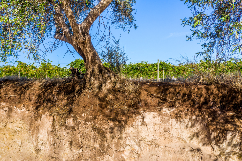
This unit includes dark grey and brown clay, silty clay, and sand and gravel deposited by streams flowing from the Willunga Escarpment toward the coast. Vines are cultivated on this unit along Pedler Creek and tributaries as well as along some tributaries of the Onkaparinga River including Baker Gully and parts of Willunga Creek and Maslin Creek.
The Alluvial Clays of Valleys were used for viticulture and horticulture prior to the development of modern irrigation technologies due to high natural soil fertility, good water retention properties and the often shallow depth of groundwater in low lying and swampy areas. In some locations vines are still grown with little or no irrigation.
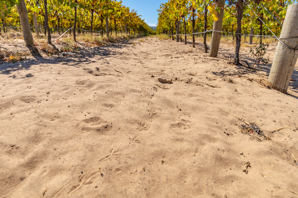
Unconsolidated quartz sands are common in many areas, particularly from south of McLaren Flat to Kangarilla. These deposits have formed by the winnowing, transport and deposition of materials most likely derived from underlying formations including the North Maslin Sands, the South Maslin Sands and the Pirramimma Sandstone.
Vineyards established on these
sands are often grown with
little or no irrigation, as water is
readily available for plant uptake and underlying clayey horizons form
a barrier for the infiltration of water
past the root zone. Where the sands
occur as thin drapes and spreads,
vine roots penetrate the underlying
geological units. Vineyards planted on
these sands include those at Sabella
Vineyard, Scarpantoni Estate and
Yangarra Estate.

Glossary of terms
Aeolian: Geological formations resulting from wind action
Alluvial: The deposition of sediment in river and creek channels and on floodplains
Alluvium: Deposits consisting of unconsolidated gravel, sand, and smaller sediment
Alluvial fans: An often triangular-shaped wedge of sediment. Alluvial fans are usually created when flowing water interacts with mountains, hills, or canyons walls
Basin: A low-lying areaCalcareous:Soil derived from rock containing calcium carbonateChannel lag conglomerate:Coarse material that accumulates inthe channel of a stream
Down-faulting: The downthrown side of a faultEmbayment:The formation of a bay in the coastlineFluvial:Landforms or deposits formed by the movement of water courses
Fossiliferous: Rocks or soils that contain fossils
Incised: A river that has cut downward through a riverbed
Interbeds: Inter bedding occurs when beds of a particular geological unit lie between or alternate with beds of another geological unit
Marginal marine environments: Environments that form the boundary between the land and the sea such as lagoons, estuaries and tidal zones
Massive soil structure: A soil that has no structure
Succession: A series of strata or rock units in chronological order (newer units sit above of older units)
Transgressive dune fields: Dune systems formed by the movement of wind or have migrated due to wind action
Tributary: A river or stream that flows into a larger river or lake
Unconsolidated: When particles or sediment in a geological unit are loose or not cemented together
Winnowing: The removal of fine sediments from coarse material by wind